Technology
Amarnath tragedy could have been averted if Doppler radar at Banihal was functional

New Delhi, July 9 : More than two years after the announcement, Doppler radar at Banihal in Union Territory (UT) of Jammu & Kashmir is still not functional. It is a crucial missing link that could have helped avert the tragic deaths of over a dozen people at Amarnath Shrine in the UT on Friday.
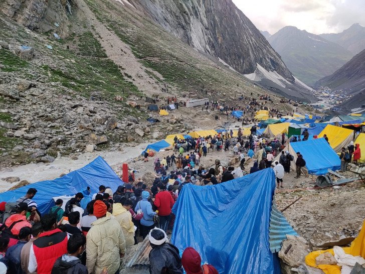
At least 15 people were killed, and several others suspected to be washed away at the holy cave shrine of Amarnath on Friday evening due to a flash flood from heavy rainfall.
The IMD had forecast only 'very light rain' and later said that such localised high rainfall events occur regularly even when authorities term it as an event of cloudburst. The Yatra has been suspended temporarily in wake of the chaos and persisting bad weather conditions.
A Doppler radar is an important tool that gives the India Meteorological Department (IMD) a more accurate assessment of the clouds and rainfall in the given range of the radar, 100 km in case at Banihal.
At Banihal, this Doppler radar is an X-band radar to be installed at a high point to get clearer access to the atmospheric changes in the hilly terrain. The location is under the Defence Geoinformatics Research Establishment (DGRE), that too at a high altitude, away from any village. "That is the reason, there are accessibility issues too. Also, it may have been announced earlier, but the procurement procedure is a lengthy process. It takes time," said a scientist from IMD.
The radar is slated to cover the entire Pir Panjal range and once functional, would also be helpful in predicting better weather forecast for the 270 km Srinagar-Jammu national highway, the main road used by Amarnath Yatris.
IMD's Upper Air Instrumentation Division is working on giving the final touches and currently the testing is going on.
IMD's Director General (Meteorology) Mrutyunjay Mohapatra said, "the work is going on."
The IMD has automatic weather stations (AWS) all along the Yatra route, both from Pahalgam side and the Baltal side. However, they only give data for realised weather, i.e., for what has happened, light rain, thundershower, heavy rain, or snow fall etc. That data is useful in the long term.
Data from the Doppler radar, as it gives a real time assessment, is helpful for the local administration and the disaster management personnel, especially so for the hilly terrain, as the advance information about the ensuing extreme weather event can prevent fatalities.
"The Radar is already installed and will be made operational this coming week, if all goes well," said Sonam Lotus, who heads the Regional Meteorological Centre at Srinagar that looks after the UTs of Jammu & Kashmir and Ladakh.


